|
|
|
|
Bellinghausen Sea and The Approach to Peter I ØY
November 21st, 2008
Ships Program Quote of the Day- "The suspension of life that occurs onboard ship is addictive. At sea you are always in transit, in transition. Nothing is fixed. Everything is immanent. A storm could come. A whale could break the surface. The future could hold anything." - James Gorman
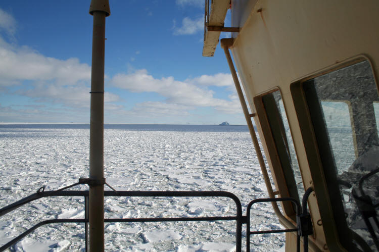
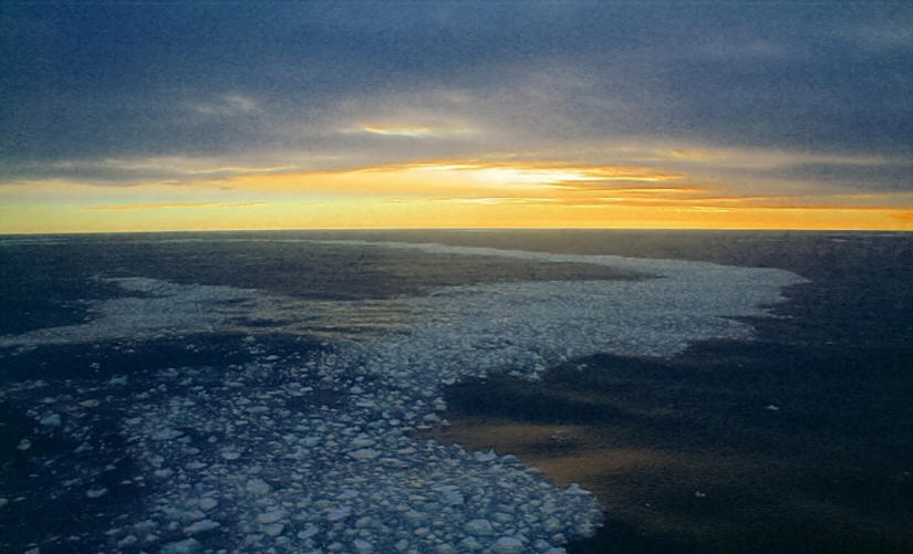
Cruising the Ice Edge, more or less 70°South Latitude, heading west Today we are mostly in open water, but staying near the ice pack edge because the sea is smoother near the ice, and this gives us a nicer ride, while allowing us to maintain a decent speed.
Being a sea day, our fine staff continues to be determined to make us a smarter group. In the morning, Bob gave us an historical talk on Antarctic Sealers & Sealing. Later, our Artist in residence David McEown gave an Introduction to Digital Photography & Composition. 1200 Hrs Cruising open water near the ice edge 69°49'South by 78°18'West After lunch David gave an Art Workshop on Drawing Penguins, which I did not participate in , but judging by the results posted in the lounge, he taught the concepts well. In the afternoon, Norman gave us a talk on Continents on the Move concerning the mechanisms of continental drift.
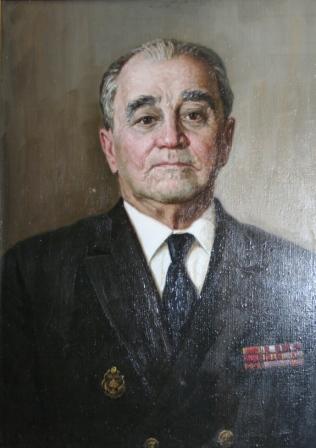
I decided since it was more of a day of education than sightseeing, I paused at the portrait of Yuri Khlebnikov to read his biography which was posted next to his portrait.
Yuri Khlebnikov "Yuri Khlebnikov was born in Warsaw, in the year 1900. As a young man of 16 he entered the marine college in St. Petersburg, where his family was living. After one year of studying, he was drafted into the Navy to fight in the first World War. The "Great October Revolution" disbanded the Navy College, which forced him to work as a stoker on the cargo ship "General Suvorver". This ship supplied Murmansk from France and England. In 1922 he joined the Soviet Navy on the Ice Breaker "Feodor Litke" as a provision Master and 2nd navigator. As a result of this experience, he passed his exams and got a certificate as a Chief Officer. As Chief Mate on the "Admiral Stepan Makarov" he participated in the famous expedition to Franz Josef Land in 1929. In spite of the heavy ice conditions the ship worked her way to the Tikhaya Bay where the northernmost station was built. In 1930 he was sailing on the "Sedov" to explore the area around Franz Josef Land and the Kara Sea. Chief Mate Khlebnikov played a major role in this expedition. Two years later Khlebnikov worked on the ship "Admiral Sabiryakov" which sailed through the Northeast Passage in one journey and was the first ship to do so successfully. Throughout the next few years Khlebnikov took part in the construction of a polar station on Severnaya Zemlya hunting for seals and assisting ships through the Northeast Passage working as Chief Mate on the Icebreaker "Feodor Litke". The Northeast Passage played an important role for Russia during the Great Patriotic War. Not only did Khlebnikov have to battle the ice in the war but German Submariners as well. These subs attempted to halt cargo transportation across the passage. Following the war Khlebnikov was captain on many icebreakers including the "Krasin", "Urmiek" and the "Admiral Muskarov". In 1969, Kapitan Khlebnikov retired after 32 years of navigation in the Arctic. His achievements as an ice master were recognized by many great leaders and scientists. Even after retireing he still took part in the training of many ice captains and was said to be an "exceptional man" to work with. In commemoration of Khlebnikov's great achievements, an island in the Kara Sea (near Novaya Zemlya) and a FESCO owned icebreaker bear his name." Biography text posted next to his portrait on board the I/B Kapitan Khlebnikov
After dinner, I wandered about the deck taking in the streaks of broken sea ice we were cruising past as we headed West in the "Serene Seventies".
November 22, 2008 Ship's program Quote of the Day- The grand show is eternal. It is always a sunrise somewhere. The dew is forever falling. Vapor is ever rising. Eternal sunrise, eternal sunset. Eternal dawn and glowing. On sea and continents and islands. Each in its turn as the earth rolls. And for this I am forever grateful to be alive. - John Muir
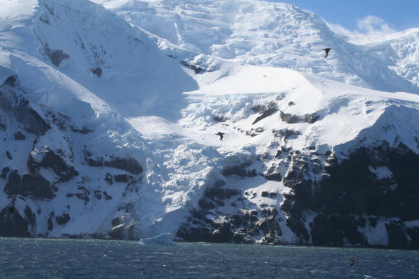
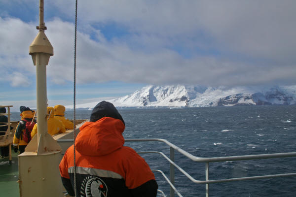
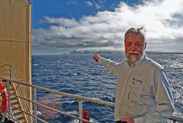
Peter I ØY 68°49'South by 90°45'West 0900Hrs We arrive at this remote, forbidding island. As far as is known, less than 800 people have ever landed on this island, and many of those have been from this ship on previous voyages.
As Bob Headland points at Peter I, you can see that much of the island is hidden in clouds, and what is not, is either rocky cliff, or snow covered.
Much of the information in this posting about Peter I is excerpted from a well written handout by Bob Headland, titled Peter I ØY - [All you ever wanted to know but were afraid to ask] dated 20 November 2008
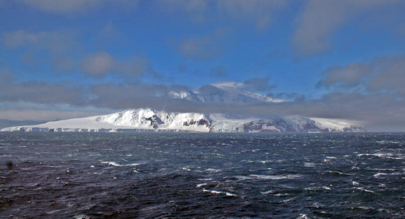
As we approach the Island, the clouds let up a bit, allowing us to see more of its rough features. This Island rises 1640 meters above the sea, but if you measure it from the sea bed, it rises almost 4000 meters from the floor of the ocean.
The first Landing was made February 2, 1929 from the vessel Norwegia during an expedition led by Ola Oldsted, and the island was formally claimed for Norway at that time.
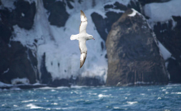
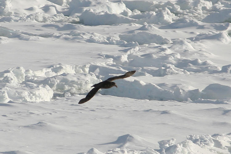
The sea was rough, and the fulmars and petrels were out in force, enjoying the wind.
An Antarctic Fulmar silhouetted against the cliffs of Peter I
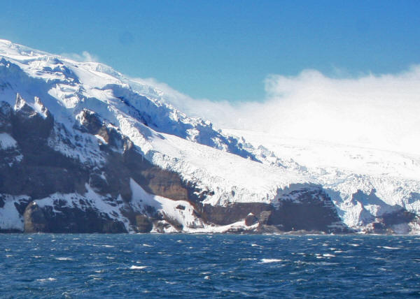
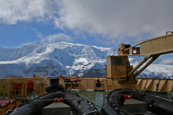
In the center of this shoreline is the small bit of beach that was our target for landing. But, as you can see, the seas were rough, and the wind was strong. Jonas set a zodiac in the water and tried to see if it would be possible to land, but as we watched, the sea tossed him about quite a bit, and as soon as he was out of the lee of the ship, the wind tried to pick up the front of the Zodiac and flip it backward. Jonas wisely returned to the ship and deemed it not safe to attempt a landing.
So, we cruised around the Island taking a look at it from the ship. Considering the difficulty that humans have had landing this island over the years, I was not disappointed, and we had a wonderful view of it, which is pretty unusual, and greatly appreciated.
A view of Kapp Ingrid Christensen.
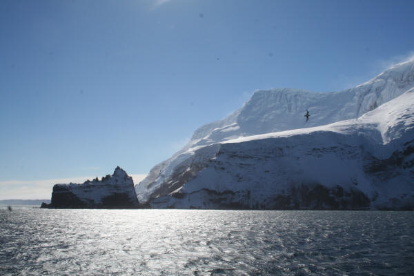
A view of the north end of Peter I from the flying bridge
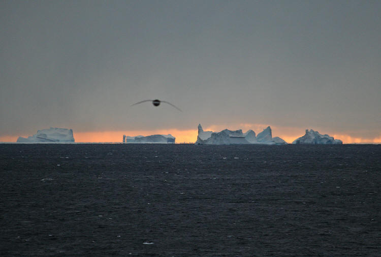
A parting view of the entire island, almost free of clouds. This is the last land (and the last open water) we will see for over a week.
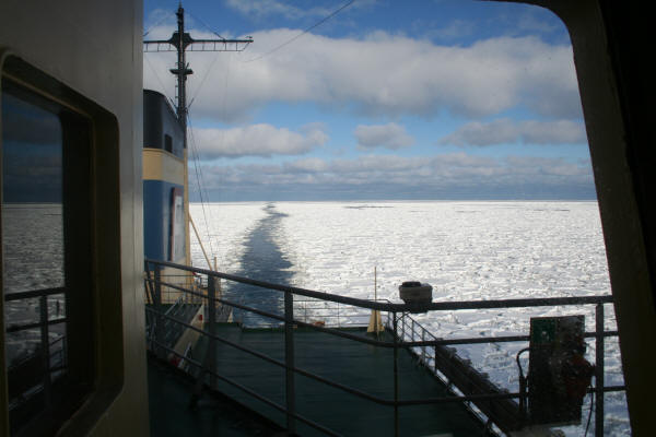
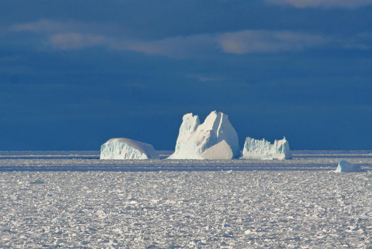
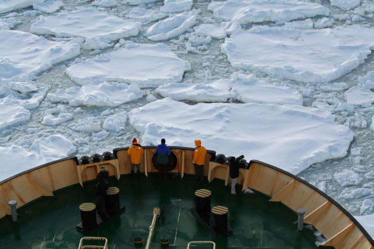
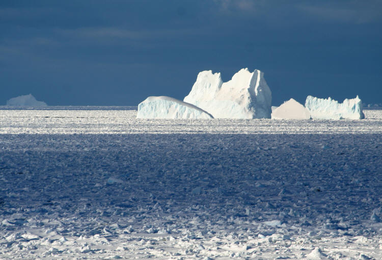
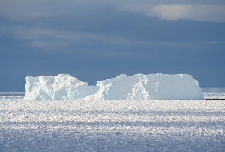
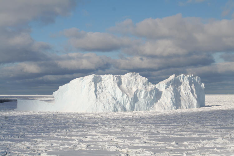
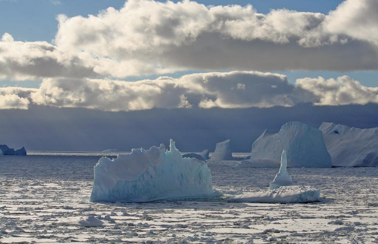
1200 Hrs 68°44'South by 91°32'West At sea, heading to The Ice We now are heading west-south-west toward the ice pack. From this point until we reach the Ross Sea, we will be breaking ice. The mind has a great deal of difficulty accepting The Ice as being a seascape. One finds oneself thinking of what one sees in terrestrial terms, pack ice becomes a windblown desert, bergs become mesas and mountains. I found myself constantly reminded of Monument Valley in Utah, but painted in a palette of whites, greys and blues. In the perception of the mind, leads of open water become rivers between shores of white. If you find yourself thinking you are seeing land in the pictures of the next several days, your mind too has been fooled by The Ice.
As we enter the pack, we leave a thin trail of open water behind us, the will soon be erased, leaving no sign of our passing. We are the only ship operating in the icepack so far this season. We will be alone in this "desert made from water".
I should say "alone" as far as other ships and other humans. We soon find that this "desert", The Ice, has many inhabitants, from zooplankton growing on the underside to the penguins and seals on its surface.
This afternoon, Kara Weller gave us a lecture on The Antarctic Food Web and we learned that all the animal life in Antarctica feeds directly or indirectly on the krill and zooplankton. As we break ice and turn over bits of broken flow, we see the reddish brown coating on the bottom of the ice, which is the zooplankton, which needs the light that comes through the ice, and feed on the rich nutrients that well up on currents from the deep. The krill in turn 'graze' on the zooplankton, and pretty much everyone else living down here eats the krill, or eat that which eat the krill.
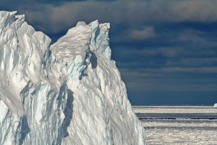
It is very difficult to convey the scale of things in this ice environment. This iceberg is easily twice as tall as our ship.
Now just a few pictures as we travel through the ice
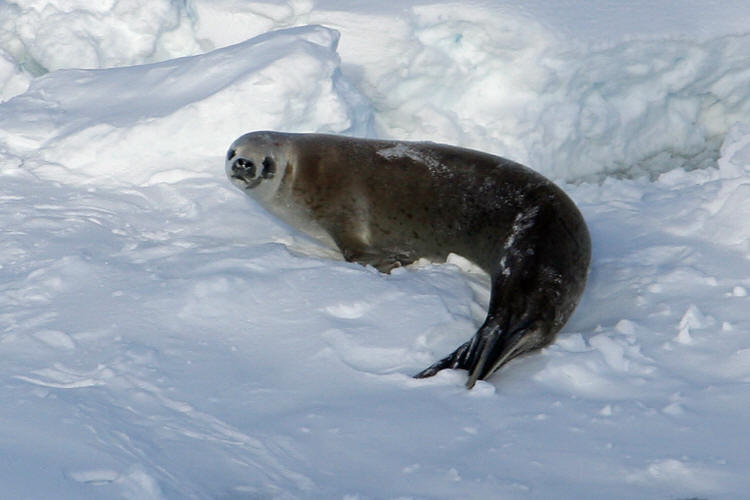
A Crabeater Seal watches us cruise by from its place on the sea ice
Crabeater seals do not eat crabs. They eat krill. A small part of their diet comes from fish and squid. The name may come from an Anglicization of a Scandinavian word for krill. They can weigh as much as 880lbs and can be as long as 8 ft. They are usually found on pack ice and can be recognized by their pig-like snout. Their bodies frequently bear scars on the flanks. They tend to bolt for short distances when a ship approaches.
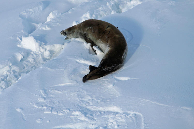
Crabeater moving away from ship, leaving characteristic trail in the snow.
Sometimes the iceforms remind me of Monument Valley in the southwestern United States, but done in blue, grey and white.
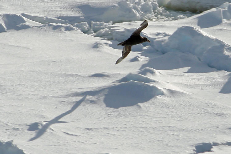
A Southern Giant Petrel flies along with us
Twilight at about 10:30pm. It never really gets dark now that we are below the Antarctic Circle.
On to November 23-24, 2008 Breaking Ice and drifting in the pack |


 Peter
I was discovered on January 20, 1821 by Fabian Bellinghausen while in charge of
a Russian expedition, who was not able to approach any closer than 25 km due to
Ice conditions. It was not sighted again until 1899, when the ship
Belgica drifted south of it while stuck in ice, which confirmed it was an
island.
Peter
I was discovered on January 20, 1821 by Fabian Bellinghausen while in charge of
a Russian expedition, who was not able to approach any closer than 25 km due to
Ice conditions. It was not sighted again until 1899, when the ship
Belgica drifted south of it while stuck in ice, which confirmed it was an
island.